Dunbarton – Koerber

Stark Highway North
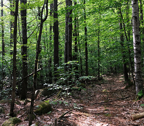
131 acres of forest and streams
Public access, no formal trails
November 2021

The Koerber Family Forest contributes to a large block of approximately 650 acres of conserved land nearby, including the Stone Farm and the Farley property, which were conserved by Five Rivers in 2017 and 2013, respectively. In addition to protecting three headwater streams and providing important wildlife habitat, conserving the land creates opportunities for future pedestrian trails and use as an outdoor classroom for the neighboring Dunbarton Elementary School.

“I am thrilled that this land will remain a farm in perpetuity for the public to enjoy, and that wildlife will have a secure home here, thanks to Five Rivers and their many generous donors,” said Ken Koerber. Ken and his wife, Susan, raised their three children on the land, and the couple owns and operates Chanticleer Gardens, dedicated to producing organically-grown cut flowers for local florists and retailers.

“The Koerber’s farm is located right in the center of Dunbarton and preserving it as open space is crucial in maintaining the rural character of our town,” said Brett St. Clair, chair of the Dunbarton Conservation Commission.

Conservation of the Koerber Family Forest is the culmination of a multi-year effort by Five Rivers to raise the necessary funds and finalize the purchase of the conservation easement, after the Koerbers’ initial offer to donate half of the value of the easement. The project was made possible by several critical state and community funding partners, including New Hampshire’s Land & Community Heritage Investment Program (LCHIP), which awarded a $100,000 grant to the project; the Dunbarton Conservation Commission; the Merrimack Conservation Partnership; the New Hampshire State Conservation Commission “Moose Plate” Conservation Grant Program; the New Hampshire Drinking Water and Groundwater Trust Fund Grant; as well as over $19,000 in private donations.

Continue Reading

Dunbarton – Stone Farm

Stone Road
237 acres of farmland, fields, and forest
Public access, no formal trails
January 2017

The rich history of Stone Farm goes back to the 1780’s when the first Stone ancestor farmed this land and is evidenced by spectacular foundations and cellar holes that tell the story of two centuries of life and farming in this corner of Dunbarton. Generations of the Stone Family raised agricultural crops from hops to apples to dairy cows. Today, hay from the farm feeds beef cattle. Logs and firewood are harvested sustainably. Visitors can see relics of buildings from long ago. Wildlife roams freely through the Stone Farm and surrounding conserved lands – now over 600 acres in all.

To learn more about the history of the farm, click here.

The Dunbarton Conservation Commission plans to create a public trail on the property in the near future, exploring some of the remarkable stone foundations and stone walls that speak to the land’s past use.

Geological Center of New England

Stone Farm is also significant because, according to several geographers, it is the geological center of New England. From science.answers.com: “The geological center of New England is located at 43.117199 degrees latitude and -71.593498 degrees longitude, at the intersection of Guinea and Stone roads in Dunbarton. The person to officially answer that question was Suchi Gopal, professor in Boston University’s Department of Geography and Environment. Gopal used the center of gravity, or “centroid,” method. “A mathematical calculation that uses a digital representation of the six New England states is the most accurate because it’s based on a math algorithm that the computer uses to calculate the center based on the boundaries,” Gopal said. Her calculation, she added, also took into account the irregular coastline of Maine and the islands off the coast of Massachusetts.

In fairness, there are other methods for determining the geographic center of New England and other towns also make the claim: Norway, Maine; Wakefield, NH; and Sanford, Maine.

Continue Reading

Dunbarton – Farley

farley-pageGrapevine and Guinea Roads
256 acres of fields, forest, and wetlands
No public access
December 2013

In 2013, Anne Farley donated a conservation easement on 256 acres in Dunbarton to Five Rivers Conservation Trust. Anne, who has lived on the property for 36 years, refers to it as the “Lord Farm” in recognition of the family that farmed the land for generations.

Located on Grapevine Road and Guinea Road, the property includes a combination of fields, forests, and a large vegetated wetland associated with Bela Brook, a town conservation priority that originates just beyond the property and flows through it. Anne’s land rises 440’ from the wetland to the east boundary, and the change in vegetation reflects this change in topography.

Over the years, Anne has raised sheep, goats, chickens, and horses on the property to which she and her husband Earl retired. Although Anne no longer has chickens, a bobcat visits the farm regularly in search of remembered prey. She has carded, spun, dyed and knitted the wool into many fine pieces cherished by those who now wear a piece of our agricultural heritage.

Continue Reading

Dunbarton – Burack

burack-page Black Brook Road at the Goffstown town line
67 acres of forest with extensive wetlands and brook frontage
Public access, no formal trails
May 2000

The Burack-Cathcart easement in Dunbarton has 1,000 feet of road frontage, providing scenic views of an open-water beaver marsh and the abundant wildlife it attracts, including moose, beaver and migrating waterfowl.

The property supports a wide diversity of both wetland and upland habitat. The upland portions are dominated by knolls forested with mature mixed hardwoods, hemlock and mixed softwoods.

In the 1990’s the property was nearly developed as a residential subdivision. Two abutters, assisted by the community were able to purchase the property from the developers. They subsequently established a conservation easement with Five Rivers Conservation Trust to protect wildlife habitat, while allowing recreation and limited forestry.

Continue Reading