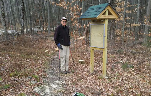
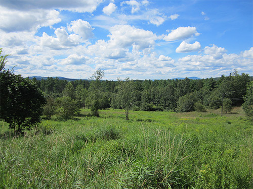
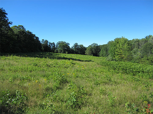
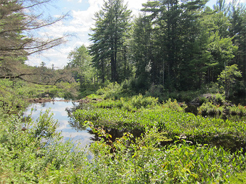
Stark Highway North
131 acres of forest and streams
Public access, no formal trails
November 2021
The Koerber Family Forest contributes to a large block of approximately 650 acres of conserved land nearby, including the Stone Farm and the Farley property, which were conserved by Five Rivers in 2017 and 2013, respectively. In addition to protecting three headwater streams and providing important wildlife habitat, conserving the land creates opportunities for future pedestrian trails and use as an outdoor classroom for the neighboring Dunbarton Elementary School.
“I am thrilled that this land will remain a farm in perpetuity for the public to enjoy, and that wildlife will have a secure home here, thanks to Five Rivers and their many generous donors,” said Ken Koerber. Ken and his wife, Susan, raised their three children on the land, and the couple owns and operates Chanticleer Gardens, dedicated to producing organically-grown cut flowers for local florists and retailers.
“The Koerber’s farm is located right in the center of Dunbarton and preserving it as open space is crucial in maintaining the rural character of our town,” said Brett St. Clair, chair of the Dunbarton Conservation Commission.
Conservation of the Koerber Family Forest is the culmination of a multi-year effort by Five Rivers to raise the necessary funds and finalize the purchase of the conservation easement, after the Koerbers’ initial offer to donate half of the value of the easement. The project was made possible by several critical state and community funding partners, including New Hampshire’s Land & Community Heritage Investment Program (LCHIP), which awarded a $100,000 grant to the project; the Dunbarton Conservation Commission; the Merrimack Conservation Partnership; the New Hampshire State Conservation Commission “Moose Plate” Conservation Grant Program; the New Hampshire Drinking Water and Groundwater Trust Fund Grant; as well as over $19,000 in private donations.
Trail Map and Directions
Stickney Hill Road/Millstone Drive
24 acres of pine, oak, and hemlock forest
Public access
December 2019
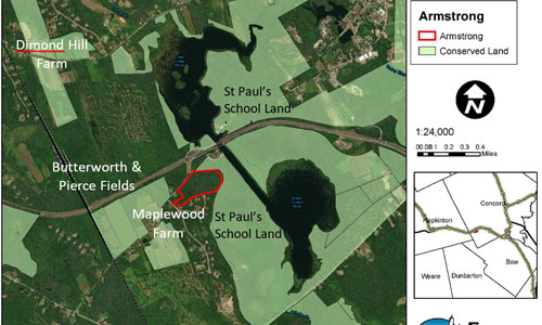
Thomas M. Armstrong and his family donated the 24-acre Armstrong Forest Preserve to Five Rivers Conservation Trust. Mr. Armstrong entrusted the forestland to Five Rivers with these words, “encourage active public observation, learning and enjoyment…for the study and wonder of nature, forests in particular, outdoor recreation, and the recharging of our minds, bodies and spirits.”
Located on Stickney Hill Road, the Preserve enhances, connects, and is in close proximity to St Paul’s School land and conserved land. Land to the east, is owned by St. Paul’s School. City of Concord land and the West End Farm Trail extend to the north. Three expansive fields and farms conserved by Five Rivers Conservation Trust lie to the west. If you want to visit the Preserve, it is directly across Stickney Hill Road from the botttom of the Exit 3 ramp from I-89 North.
Towering white pines and oaks cloak the new Preserve. Perimeter trails beckon walkers, runners and cross-country skiers to explore this lesser known, less crowded part of Concord.
The Armstrong Forest Preserve is a gateway to an inviting trail network of scenic discontinued town roads along the southern boundary of the property. The trail begins on Millstone Drive, passes the historic Stickney Cemetery and connects to NH Snowmobile Corridor 11.
If you want to explore the untrailed interior, you may find the vernal pool in spring and a small forested wetland. The forest has not been harvested in over 40 years and is maturing into venerable pines, oaks, and hemlocks. In winter, explore on snowshoes to learn which critters leave tracks in the snow. At other times of the year, step gently and you will discover hidden wildflowers, mosses and ferns.
Tom Armstrong, now of Scarborough, Maine, purchased this forestland in 1953, after he worked at Fox State Forest in Hillsborough. He donated the Preserve to Five Rivers in memory of his wife, Rachel Franck Armstrong, and in honor of his forestry mentors and friends Henry Ives and Birgit Baldwin, and Frances and Larry Rathbun.
130 Hutchinson Road
120 acres of forest
Public access, hiking trails
March, 2018
Five Rivers and the Town of Chichester teamed up to enhance the level of conservation for the Chichester (Spaulding) Town Forest in March 2018, Five Rivers’ first property conserved by easement in Chichester! This 120-acre working forest is located on the Chichester/Pembroke Town Line, off of Hutchinson Road in the southern part of Town. The easement adds to the Town’s other easement holdings which total nearly 400 acres.
The Town has owned most of the Town Forest parcel since the 1950s, and has carefully managed it under the professional guidance of licensed forester Charlie Moreno. Forest Management has improved the quality of the forest overall and is encouraging future growth on the best quality trees on the property. In addition to sustainable forestry, the Town’s forest management goals include preservation of wildlife habitat and promotion of passive recreation.
NH Fish and Game ranks this property among the best wildlife habitat in the state, and includes habitat suitable for creatures ranging from large mammals to amphibians. The property abuts the Humphrey Forest, conserved by the Society for the Protection of NH Forests. These properties, plus other nearby conserved land, provide over 400 acres permanently protected for wildlife to roam. Additional unprotected open spaces create a contiguous block of 1300 acres.
The property is open to the public and currently has three trails of varying length and difficulty. The highest terrain on the parcel provides some exceptional views to the east.
Many New Hampshire towns have designated Town Forests, and some people believe that these properties are conserved by that designation. However, the Town Forest designation can be removed by a vote at town meeting. The Chichester Town Forest is protected by a conservation easement, which limits its use to forestry, outdoor recreation, wildlife habitat management and conservation – forever.
Five Rivers will continue to work with the Town and the Conservation Commission to ensure that the property’s conservation values are always protected for the public benefit.
Stone Road
237 acres of farmland, fields, and forest
Public access, no formal trails
January 2017
The rich history of Stone Farm goes back to the 1780’s when the first Stone ancestor farmed this land and is evidenced by spectacular foundations and cellar holes that tell the story of two centuries of life and farming in this corner of Dunbarton. Generations of the Stone Family raised agricultural crops from hops to apples to dairy cows. Today, hay from the farm feeds beef cattle. Logs and firewood are harvested sustainably. Visitors can see relics of buildings from long ago. Wildlife roams freely through the Stone Farm and surrounding conserved lands – now over 600 acres in all.
To learn more about the history of the farm, click here.
The Dunbarton Conservation Commission plans to create a public trail on the property in the near future, exploring some of the remarkable stone foundations and stone walls that speak to the land’s past use.
Geological Center of New England
Stone Farm is also significant because, according to several geographers, it is the geological center of New England. From science.answers.com: “The geological center of New England is located at 43.117199 degrees latitude and -71.593498 degrees longitude, at the intersection of Guinea and Stone roads in Dunbarton. The person to officially answer that question was Suchi Gopal, professor in Boston University’s Department of Geography and Environment. Gopal used the center of gravity, or “centroid,” method. “A mathematical calculation that uses a digital representation of the six New England states is the most accurate because it’s based on a math algorithm that the computer uses to calculate the center based on the boundaries,” Gopal said. Her calculation, she added, also took into account the irregular coastline of Maine and the islands off the coast of Massachusetts.
In fairness, there are other methods for determining the geographic center of New England and other towns also make the claim: Norway, Maine; Wakefield, NH; and Sanford, Maine.
557 Buck Road
46.3 acres
Public access, no formal trails
April 2011
The Hillman family owned these lands for over a hundred years and farmed them until the 1960s. Since then Stan Grimes and his family have been leasing the fields and growing corn. In 2008, the Hillman children, now in their seventies, were forced to put the property on the market. Initially a developer was the top bidder but after the deal fell through, Stan Grimes and the Hillmans reached out to the community for help in preserving it.
Ammy Heiser and the Pembroke Conservation Commission had protected small parcels in the past but the amount of money needed to do this deal was much bigger than anything they had faced before. Ultimately, they learned about the Farm and Ranch Lands Protection Program from the U.S. Department of Agriculture. But in order to get a grant for matching funds from the government they had to demonstrate the farm’s historic significance. State historian James Garvin stepped in and wrote a letter documenting that the area had been farmed since it was first settled in 1755 and has always had prime agricultural soil. The USDA agreed and in 2011, the Town of Pembroke put the issue to the voters and between the federal money and money from the local conservation fund, it bought the land. Shortly thereafter, the town placed an easement on the land under the stewardship of Five Rivers. This fulfilled the desire of Marilyn Hillman and her siblings to honor the memory of their parents.
The Grimes continue to lease the land from the Town of Pembroke and it remains a working farm. There are trails along the perimeter of the corn fields stretching back to the Suncook River but, during the growing season, access and ease of walking may be limited. The best time to visit is after the harvest and during the winter when the fields are cleared and there is no risk of damaging the crops. With the fields cleared there is plenty of space to walk around and, in the winter, to snowshoe and cross-country ski. Be advised that hunting is also permitted on the property so it is important to wear bright clothing and stay alert while visiting during hunting season.
Off of NH Route 106 and Currier Road
79 acres of softwood forest with frontage on the Soucook River
Public access
August 2004
The Nature Conservancy donated an easement on 79 acres of highly productive forest in Loudon in 2004. The easement was crafted to allow commercial forestry while guaranteeing that the productive capacity of the property is maintained and protected. Subsequently Jack and Mary Bronnenberg purchased the property with the intention of practicing sustainable forestry and habitat conservation on this spectacular pine lot. Jack Bronnenberg and his son Jake have a reputation for excellence in forestry, and they will bring their expertise to bear in the sensitive forest management of this property.
The property has 1,200 feet of frontage on the Soucook River, as well as significant frontage on Rte. 106. and both sides of Currier Road in Loudon. Numerous vernal pools and other pocket wetlands dot the property. Two existing trails cross the property, which has an extensive glacial formations known as an eskers, which is a long ridge of sand and gravel left by the melt water pattern of the last glacier. Nearby eskers have been mined or eliminated for use as construction material, but this esker will remain intact thanks to the easement restrictions.
Off Loverin Hill Road
139 acres of fields and forest
Public access
April 2012
The 139 acres on Loverin Hill Road has a long, rich farming history and a bright future, thanks to Joseph Schmidl and Cynthia Owen. From the 1760s into the early 1900s, this land was home to Fairview Farm. However, over the following fifty years, most of the fields returned to forest.
In 2010, the land went up for sale and a developer came forward with a proposal to build thirty houses. When Joe and Cynthia heard about the potential development, they decided they couldn’t let that happen and brought together the resources to buy the property. As Joe Schmidl pointed out, the proposed development would have more than doubled the number of houses in their corner of Salisbury. Their bid was accepted and immediately after, they entrusted the easement to Five Rivers.
The family plans to build a house on a lot next to the easement and put the land back into production on a small scale. Joe has a sugar shack and taps the maples on the property and there is already a cleared field that can be turned into pasture. There are plans for the sustainable harvest of white pine and red oak and the Schmidl-Owens also make blackberry and raspberry jam from the fruit bushes that line some of the property’s trails. The bushes are for the family’s use and so you should refrain from picking the berries during your visit. The basic rule is, a few for tasting is fine, but not for taking home.
The family wishes to share the land with the public; there are trails on the property that Joe periodically clears and are available for recreation, with the exception of motorized vehicles. Currently the trail on the western edge of the property is in the best condition. Walk about 10 minutes on this trail and you can make out a stone formation that is believed to be the cellar of the original farmhouse. Some of the other trails that run behind and alongside the field have deep skidder ruts that can fill up with water after a heavy rain. Joe says that the best time of year to visit the property is after the trees have lost their leaves in the fall and there are clear views of Mount Kearsarge and the surrounding landscape. The trails are perfect in the winter for snowshoeing and cross-country skiing and are nice for walking throughout the year. Some of the neighbors ride their horses on the trails so don’t be surprised if you happen to come across them.
The property is in its early stages of development and, with all it has to offer already, it has great potential. With plans to further develop recreational access and production on the property the Schmidl-Owens hope to see the return of the Fairview Farm.
Little Tooky & Penacook Roads
46.7 acres
Public access, no formal trails
November 2011
Sloping down from Penacook Road is an overgrown meadow of what used to be a chicken farm. The remains of old chicken coops can still be found on the property. At the base of the hill there is an overgrown railroad bed, part of what was the Concord and Claremont line. The Town of Hopkinton purchased the property using an Open Space Bond and passed the easement on to Five Rivers in 2011.
The field is part of what defines Contoocook as a rural area and the town preserved it before there was even a chance for development. Power lines cut across the field but do not take away from its beauty. Far and away the highlight of the property is its magnificent view of the New Hampshire landscape. Mt Kearsarge stands to the north and you can make out its summit fire tower on a clear day. There is a provision in the easement that the field will regularly be mowed to maintain the view.
There is no parking along Penacook Road but it is possible to pull over near the intersection with Gould Hill Road for pictures. However, there is also no designated lookout area so please use caution if you do step out of your car.
Maple Street
210 acres
Public access, no formal trails
November 2011
The Rice easement is largely forest that lies between Maple Street and the Contoocook River in Hopkinton. It was purchased by the Town using an open space bond. Hopkinton then went to Five Rivers in 2011 to place a conservation easement on the property.
A corn field lies along the northern edge of the woods. An old farm road cuts through the property to give a local farmer access.
There is no easy way to get to Rice, nor are there any trails once you reach the property. However the land is popular with hunters. Its wetlands and vernal pools attract deer, turkey, and other small game. The Town plans to hire a forest manager and sustainably log sections of the forest. If you just want to see the Rice lands, the best view would be from a boat on the Contoocook River.
Trail Map
Dustin Road
35.8 acres of forests, wetlands, and farmland
Public access
November 2014
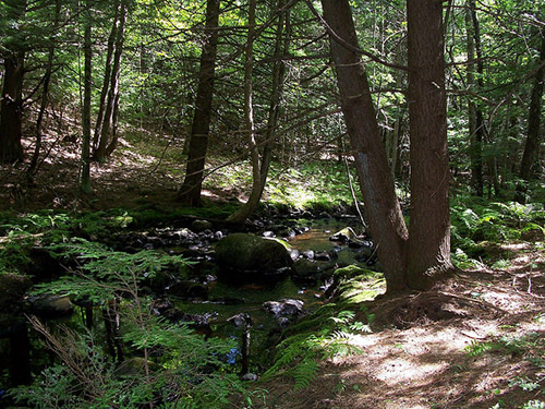
The Dustin easement is almost completely forested. One area near the road was most recently pasture and is now a nearly pure stand of white pine. Most of the property is upland forest consisting of a mixture of scattered larger white pines with some red oak above an understory of smaller oak, red maple, beech and birch. There is a flood plain forest near the river consisting of silver maple with some elm and abundant shrubs. There is a hemlock stand near the stream.
The property has outstanding wildlife habitat value due to its varied habitats and proximity to the river. The NH Wildlife Action Plan shows this property as abutting and supporting some of the highest ranked habitats in the region.
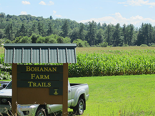
Wetland areas are near the river and include over 1,600 feet of frontage on the Contoocook River. The property has over 825 feet of scenic frontage along Dustin Road. Trails connect to the Bohanan Farm Trail network.
Farrington Corner Road
35 acres of forests and wetlands
Public access
June 2006
The Carson Property is a 35-acre parcel located along Farrington Corner Road in Hopkinton. It is owned by the Town of Hopkinton, which signed the property’s conservation easement in June of 2006.
A former pasture, the Carson Property now consists of extensive forest stands, notably red oak, hemlock and other species. A small brook courses its way across an undulating terrain of glacial deposits. Beneath the property the bedrock is both Concord Granite of Devonian age and a Silurian age schist of the remarkable Smalls Falls Formation.
The property is located next to New Hampshire Audubon’s Brockway Nature Preserve, a parcel with some delightful walking trails. The newly-protected Carson Property creates an additional forest buffer around that preserve, thereby serving to expand the conserved acreage in this part of Hopkinton while enhancing the experience for those who enjoy the nearby Audubon preserve.
Bohanan Farm has been in existence since Lester Bohanan bought the land in 1907. From the 1930s on, the farm became primarily a dairy farm and has grown with every new generation. Lester’s great-grand-daughter, Heather, married Jaime Robertson, who currently manages the over 400-cow operation.
In 2008 the family decided the best way to ensure the land remained unaltered for future generations was to place an easement on it. However the cost to do so was quite substantial and Jaime asked the Town of Hopkinton if they were interested in purchasing the development rights. Hopkinton’s Open Space Committee began building support for the idea among the voters while Five Rivers got involved and raised money through state and federal grants as well as generous private donations. The State of NH and the National Resource Conservation Service through its Farm and Ranch Lands Protection Program also provided valuable assistance.
In the largest town meeting in the town’s history, Hopkinton residents overwhelmingly voted to preserve the farm. After the land was under easement, Jaime decided to widen the scope of the farm. He created the Contoocook Creamery and you can find their milk in traditional glass bottles in many local grocery stores. The Robertsons also sell eggs and have started raising cattle for beef, not just milking. Blueberry and raspberry patches are also in the works and should be ready for the public in a couple of seasons. Logging has always brought in extra income for the farm but is done in a sustainable manner. There are large cornfields on the property that produce about 50% of the cow’s feed over the course of the year.
For years there have been trails on the property that were open to the public but now that Hopkinton maintains them, there is a designated parking area and they are clearly mapped and marked. Click here to access the Hopkinton Conservation Land website, which includes a full description of all Bohanan Farm trails and access to trail maps.
The Courser Hill Loop trail is a 2.3 mi round trip and starts from the parking area. It heads along the Contoocook River past a canoe and kayak launch, around a field and then cuts inwards towards Courser Hill. Once in the woods the trail divides into the loop portion. The trail has a long stretch through the woods and another sizeable stretch that cuts through Courser Hill pasture and over the top of the hill. At the top of the field there is a small grove of trees with an old cellar hole at the center. You should be aware that at certain times of the year there may be cows grazing in the pasture.
Across the road from the main farm, along Burrage Road, there is the 1.5 mi Blackwater River Loop trail. It cuts in past a cornfield and leads into the woods. There is a lookout point over the Blackwater River on the north-west part of the trail. The path also leads past several vernal pools. This trail is ideal for cross-country skiing and biking in addition to being a nice walking route.
The newly added Contoocook Overlook Trail (conserved by the Town of Hopkinton and owner Donelda Horne and not Five Rivers) leaves the Blackwater River Loop at the half way point, adding ¾ of a mile to the Blackwater Loop (2.2 miles total with the overlook trail). The trail follows a bluff above the Blackwater River before turning toward the Contoocook River where an overlook provides beautiful views where the two rivers converge. The trail climbs a short hill to a bluff along the Contoocook River, follows through mature woodlands with views over Bohanan fields, and rejoins the Blackwater River Loop. Click here to access the Hopkinton Conservation Land website, which includes a full description of the Contoocook Overlook Trail and access to trail maps.
After your hike, don’t forget to say hello to the cows. They’ll appreciate it.
Bound Tree Road
111 acres of forests and wetlands in both Hopkinton and Warner
Public access
June 2006
The Bermuda-Harris Property, which is owned by the Town of Hopkinton, is an attractive 111-acre landscape that straddles the Hopkinton-Warner town line. It fronts on both Bound Tree Road and Pleasant Lake Road, both in Hopkinton. The Town signed a conservation easement for the property with Five Rivers Conservation Trust in June of 2006.
This preserve is particularly well suited for recreational trails that allow public access to some wonderful natural features. Mature stands of hemlock, pine, and hardwoods, as well as a large black gum tree rare to this northern environment, are just a few of the property’s attributes. Also, in addition to a delightful brook, once used in the 1700s to power a small, long-since-disappeared mill, the forested landscape is graced by a remote, hidden, beaver pond. Along with a number of surrounding vernal pools, this isolated wetland, as well as the rest of the forestland, is frequented by deer, turkeys, hawks, songbirds, and other wildlife. The Bermuda-Harris Property also exhibits some interesting glacial formations, as well as old cellar holes and other legacies from a bygone era.
Perkins Road
30 acres
Public access, no formal trails
May 2009
The Perkins Farm, a 30-acre property consisting of two parcels, is located off of Perkins Road in Gilmanton. The property was trusted to Five Rivers in May of 2009. Prior to its conservation, the landowner cleared the property. The parcel on the NE side of the road (Area One) was clearcut about 15-20 years ago, in anticipation of making a new field that never happened, and now consists of brushy, young growth. The SW parcel (Area two) is more mature forestland, albeit heavily logged a while back.
Area one has direct access to a dirt road leading back to Perkins Road. A woods road runs through Area Two and is used as a snowmobile trail in the winter. The trail is used and maintained by the Gilmanton Snowmobile club. The woods road connects Area Two with three nearby conservation easement lots (Skantze CE, John & Ursula Allen CE, and Frank Allen CE).
The property has undeveloped frontage on Perkins Road allowing for partial, seasonal distant views of the Belknap Mountains. The Wildlife Action Plan stated the property to be a supporting landscape to the existing conservation area. The property also contains productive soil for agriculture as well as forestry; it also guarantees public access for outdoor recreation and education.
Perkins Road – Gilmanton Iron Works
25 acres of field and forests on two parcels near Crystal Lake in Gilmanton Iron Works
Public access, no formal trails
December 2007
The Howe/Thorne Easement Property, protected in 2007, is a 25-acre landscape located in the town of Gilmanton, or, more specifically, in Gilmanton Iron Works. Near the scenic waterbody of Crystal Lake, this property has been owned by Tom Howe and Sarah Thorne for more than twenty years.
It consists of a wonderful, undulating field alongside and behind their historic farmstead, a field that serves as pastureland for their neighbor’s farm. A well-maintained walking trail extends from the field’s edge, allowing hikers to stroll past acreage conserved by the Gilmanton Land Trust and which was transferred to Five Rivers Conservation Trust in 2008.
Another distinctive feature of Tom and Sarah’s property lies across the dirt road from their home, a forest they have tended with great care over the years. Selectively and skillfully harvested so as to preserve the woodlands’ value and attractiveness, the forest contains a trail system that is graced with stately red oak and other trees, interesting glacial features, and a necklace of vernal pools, so important for wildlife. Moreover, the property contains an old foundation and cellar hole from a long-ago resident…one who no doubt would have been pleased with the love and care that Tom and Sarah have shown to the property over their years of land stewardship.
Situated adjacent to and near several other conserved properties, the Howe/Thorne property, straddling both sides of Perkins Road, serves an integral role in a complex of protected lands in this section of the Town of Gilmanton. This expansive landscape holds abundant benefits, including both wildlife habitat protection and recreational opportunities.
Route 140
20 acres & 14 acres
Public access, no formal trails
2007 & 2009
Two Conserved Properties
Christie Forest
As a community-oriented land trust, Five Rivers was extremely pleased on this conservation project in the heart of Gilmanton village. Nancy Christie approached Five Rivers with a long-held dream…to preserve the land that her parents once owned, a landscape that she has known intimately since childhood, a landscape that she loved dearly.
Consisting of an interesting mix of well-tended field, a mature forest, a pretty brook that meanders through a small ravine, and, most significantly, a 5-acre beaver pond, the property enjoys one additional special feature – its proximity to the town center, a picture-postcard New England village.
Tucked just behind the Gilmanton town offices (the former Gilmanton Academy building) and located within walking distant of the town church and general store, Nancy’s land holds special value for community residents. The beaver pond itself is particularly appealing. Home to an abundance of songbirds, ducks, and other wetland wildlife, the pond provides a perfect opportunity for townspeople, and others, to explore.
Nancy placed a donated conservation easement on her land in 2007. Subsequently, she plans to give the property to the Town of Gilmanton for management by the Gilmanton Conservation Commission. What a generous present! And what a wonderful natural asset it will no doubt prove to be for the people of Gilmanton in the years ahead.
Christie Forest
On the north side of Peaked Hill, near the heart of Gilmanton village, lies a 20-acre mixed-hardwood forest frequented by deer, bear, and other wildlife. Thanks to the vision and conservation ethic of its owner, Nancy Christie, it will forever remain intact, a legacy to its former owner, Nancy’s father Walter Steenstra.
Protected via a conservation easement donated to Five Rivers Conservation Trust in 2009, Nancy’s land is the second Gilmanton property that she conserved in as many years. This hillside property, lined by stone walls, rises 400 feet in elevation to a point with extensive westerly views.
The land will remain as is, with no timbering, save for the creation of nature trails that would be used for all to enjoy.
North Road
67 acres of forest, field, and large wetlands
Public access, no formal trails
November 2007
Working with the Hillsborough Conservation Commission and the landowner, Five Rivers Conservation Trust became an executory interest holder of this attractive, 67-acre property near Hillsborough Center. The Conservation Commission holds the primary conservation easement, donated to the town by Olivia St. John Smith in 2008. Five Rivers holds executory easement.
This acreage, along North Road, has a wonderful mix of forest, fields, and wetlands. Of particular note is the property’s large wetlands, a beaver pond complex that exhibits extensive plant and wildlife diversity. This wetlands and forest is blessed with a host of wildlife that, in addition to beaver, include moose, bobcat, deer, bear, turtles, porcupine, and many species of birds.
Pancake Hill Road
105 acres of farm, fields, and forests
Public access, no formal trails
October 2006
A scenic 105-acre rural property in Gilmanton was conserved in 2006 through a conservation easement donated to Five Rivers Conservation Trust. The owners of this farm and forest landscape, Peter and Carolyn Baldwin, made the generous decision to forego the potential for its future development in order to protect it permanently.
The conservation easement deed that the Baldwins conveyed to Five Rivers ensures that the property will forever remain undeveloped, while also allowing for continued farming and timber harvesting. The Baldwins will continue to reside on their cherished land, and whenever it gets passed on to others, the property will remain as is, a perpetual open space asset for future generations.
Located on Pancake Hill Road, the property has been enjoyed by the Baldwin family for over half a century. It consists of attractive fields and farmlands graced by a distinctive wooden barn, as well as an extensive mix of mature softwoods and hardwoods. In addition to stately maples, the forest includes an immense ash tree that has a base diameter of over five feet. The property is also noted for its views of distant countryside and for its undulating topography. A clear brook tumbles its way across a forest landscape frequented by deer, grouse, and other native wildlife.
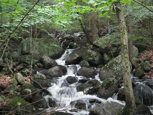
Gleason Falls Road
113 acres of forests and a marsh and abuts the scenic Gleason Falls conservation area owned by the town
Public access
July 2012
In the 1970s, Hope Thomas and her husband purchased a large tract of land across from her house on Gleason Falls Road in Hillsborough. The sheep she raises pasture in the first field but behind that, stretching back for many acres, are the woods that make up the bulk of the easement.
In the south-east corner of the property is a large pond that Hope affectionately calls the “swamp.” Herons and beavers live here; you can see the gnawed and felled trees left by the beavers near the banks. The pond itself empties into a stream that tumbles down through the property until it joins with Beard Brook.
To the west, down the road from Hope’s house there is an old woods road that takes you to the pond. Watch out for trails that seem promising but peter out. The woods road forks at one point and the right fork leads to the brook. Today, it has become overgrown with no clear path forward. The left fork leads up a hill and eventually to the pond. In the winter, you can snowshoe the trails.
Hope has hired a forest manager and there is ongoing logging activity. Some trees are marked with paint to be harvested, don’t assume that they mark a trail. Hope wants people to use the trails; all she asks is that you check in when you start and take all your trash when you leave.
The easement placed on Hope’s land has the additional benefit of connecting to land already conserved by the Society for the Protection of NH Forests, assuring that a valuable woodlands and water resource remain untouched by development.
Warner Road and Brown Brook
75 acres of wooded property, marshes, and a well-used recreational trail
Public access
November 2012
The Watman Conservation Area is made up of three separate lots of land already owned by Henniker that the town Conservation Commission decided to preserve through a conservation easement. The Conservation Commission gave Five Rivers the money to purchase the easement from the Town of Henniker and assume stewardship over the land. During the yearlong process, Selectman Thomas Watman passed away. He had been closely involved with the project and the town named the area in his honor. The north-east lot was already preserved as the Preston Memorial Forest but has been incorporated into the larger conservation area.
The tract of land on the west side of the road has a path that runs back from the road to a small clearing and Brown Brook. The mossy-banked stream comes down from the north and passes through a marsh that lies to the west of the clearing.
Throughout the entire property there are boulders, ledges, and vernal pools that give the land a special character. The southern-most lot is the only one that allows motorized access due to a provision to let ATVs continue to use an old woods road that connects to a larger ATV trail system to the east. The Watman Conservation Area lies just south of lands conserved by the Town of Warner and north of forests preserved by the Society for the Protection of New Hampshire Forests. Wildlife frequently pass through these forests, leaving tracks in the mud. The forest is also known for being a good location for spotting raptors.
There are provisions in the easement agreement that allow for forestry and agriculture if the town chooses but this is not likely in the near future. There is also the possibility of using the conserved area for educational purposes and creating a network of official trails. Development however, is no longer an option.
Western Avenue
11.36 acres
Public access and boat launch
August 2013
This conservation area serves as a memorial to Cliff Eisner, a kayaker, as well as a local teacher at John Stark Regional High School, who died in a kayak accident on the Saco River in 2006.
The easement also serves as an important launch point for whitewater paddlers enjoying the popular section of the Contoocook river that runs from Hillsborough to Henniker. This section of the Contoocook River contains rapids ranging in difficulty from Class II to Class IV.
The forest that makes up the 11 acres is a mixture of white pine, red maple and red oak with a mixture of shrubs and wetland vegetation. There are numerous vernal pools, one wetland that is larger and deeper, and a small perennial stream also crosses the property. There is approximately 838 feet of scenic unimproved frontage on Western Ave. There is approximately 1,000 feet of scenic unimproved frontage on the Contoocook River. There is the trace of an old path leading to the larger wetland.
There is a wooden bench overlooking the river and a small dilapidated wooden foot bridge. The canoe launch is an unimproved area where people carry (or slide) boats into the river. The old road at the northeastern boundary is now a grassed pathway.
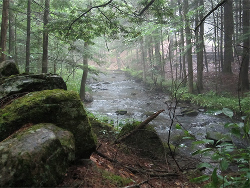
Flanders Road
61 acres
Public access, no formal trails
January 2009
Five Rivers’ Chase Brook Easement is located south of the Henniker town center. This 61-acre wooded conservation area includes a portion of Chase Brook, which is a tributary of the
Contoocook River. There is a 0.6-mile main trail that runs roughly north to south through the property and is maintained by the Henniker Trail Travelers snowmobile club. The trail ascends gradually from the access point on Flanders Road and continues off the easement onto private property.
The forest consists of a diverse mixture of coniferous and deciduous trees. Sunlight trickles through the canopy, and ferns and wildflowers cover the forest floor. When you go, keep
an eye out for Jack-in-the-Pulpit flowers whose clustered green berries turn bright red in late summer and fall.
Off-trail explorations will lead you to hills and boulders to the east and Chase Brook to the west. The brook is easy and fun to explore for both adults and children. Follow the brook upstream and you will find deeper pools to sit by in quiet contemplation or just for a good foot soak! This is a wonderful place for all to enjoy! Parking is along the road near the junction of Flanders and Craney Hill Roads.
Black Brook Road at the Goffstown town line
67 acres of forest with extensive wetlands and brook frontage
Public access, no formal trails
May 2000
The Burack-Cathcart easement in Dunbarton has 1,000 feet of road frontage, providing scenic views of an open-water beaver marsh and the abundant wildlife it attracts, including moose, beaver and migrating waterfowl.
The property supports a wide diversity of both wetland and upland habitat. The upland portions are dominated by knolls forested with mature mixed hardwoods, hemlock and mixed softwoods.
In the 1990’s the property was nearly developed as a residential subdivision. Two abutters, assisted by the community were able to purchase the property from the developers. They subsequently established a conservation easement with Five Rivers Conservation Trust to protect wildlife habitat, while allowing recreation and limited forestry.
In 2009, this scenic 85-acre city park astride one of Concord’s highest hills was created in honor of former New Hampshire Governor John Winant and his wife Constance. The park is a gift to the City of Concord from the late governor’s son, Rivington Winant, and his wife Joan. The transfer and conservation of the property was made possible through collaboration among the Winants, the City, St. Paul’s School, and Five Rivers Conservation Trust.
The City owns and manages the public park, subject to a conservation easement held by Five Rivers Conservation Trust that ensures the property will be protected in perpetuity. Rivington and Joan Winant generously donated the conservation easement to Five Rivers and then conveyed their property ownership to the City. St. Paul’s School, through a separate easement conveyed to the City with an executory interest to Five Rivers, graciously allowed construction of a parking area, trailhead, and an access trail from land the school owns along Fisk Road to the landlocked Winant property.
Former Governor Winant attended, taught at, and is buried at St. Paul’s School and served for three terms as Governor of the State. He cared deeply for both, noted his son Rivington Winant in announcing the gift to the City, and with views of both the school and the capitol, it serves as a fitting memorial.
Rivington Winant grew up on the Winant property near what is now Concord Hospital. The 85 acres is the remnant of a larger estate on Pleasant Street. The land encompassed by the new park is dominated by pine-oak forests, and includes the former estate’s bridle trails. Over the years, nearby residents have privately maintained and used the property’s extensive trail network for hiking, cross-country skiing, and mountain biking.
Construction of an official park entrance on St. Paul’s land off Fisk Road included an off-road parking area, a foot bridge across Miller’s Brook, and an informational kiosk recounting the history of the park and a biography of Governor Winant. The Unitarian Universalist Church, located on Pleasant Street, also kindly provides user access through its driveway across an existing right-of-way.
As set forth in the conservation easement developed by the parties, the park is intended solely for non-motorized recreational uses such as hiking, skiing, and bicycling. The intent of the gift is to preserve the wild nature and native habitat of the park; no park buildings, sport facilities, or other formalized structures or fields will ever be built there.
In addition to the land gift and easements, Mr. and Mrs. Winant generously funded the initial construction costs for the parking lot and clearing the trails, the kiosk, and trailside benches. The city assumes responsibility for maintaining trails and the parking area, and for other park management. Five Rivers has responsibility for monitoring and enforcing the terms of the two easements.
Winant Park provides a special open space resource for Concord, with its forested lands, trails, and open summit with views of Concord and distant countryside. It is an island of peacefulness, located right in the heart of our state’s capital city, enriching the fabric of this community.
A Brief Biography of John Winant
John Gilbert Winant was born in New York in 1889 and attended St. Paul’s School, graduating in 1908. He attended Princeton and returned to St. Paul’s, where he taught history. He left to serve in World War I, then returned to St. Paul’s to teach. While there, he became interested in politics, served in the State Legislature, and in 1925 became the country’s youngest governor.
After Winant completed his governorship, President Franklin Delano Roosevelt appointed him as the first chairman of the Social Security Board. In 1937 Roosevelt asked Winant to go to Geneva as the senior US member of the International Labor Organization, of which Winant later became director-general.
As World War II loomed, Roosevelt appointed Winant as the American ambassador to the Court of St. James in London. Winant and Prime Minister Winston Churchill became close friends. On Sunday, Dec. 7, 1941, Winant was in the room when Churchill turned on the radio and heard that the Japanese had attacked Pearl Harbor.
Throughout the war, Winant frequently traveled throughout England and is still remembered for his likeable and reassuring nature. He was presented with the ceremonial keys to a number of English cities, and at the end of the war King George VI presented him with the Order of Merit, Great Britain’s highest civilian honor.
After the war, Winant retired to Concord to write his memoirs. He is buried in St. Paul’s School cemetery off Hopkinton Road.
Hopkinton Road adjacent to Dimond Hill Farm
24 acres of farm fields
Public access
September 2012
The original owner of Dimond Hill Farm, Newton Abbott, sold these fields to one of his employees in 1932. Ever since, the land has been owned by the Triacca family and for decades, they grew corn and other crops on it.
In 2011, the Triacca family wanted to put their land up for sale and approached the City of Concord and Five Rivers about the possibility of buying it. Five Rivers led a successful fundraising campaign to save the fields. Help came from the National Resource Conservation Service, the Russell Piscataquog River Watershed Foundation, and individual donors.
In 2012 Five Rivers closed on the deal to purchase the fields and donated them to Equity Trust, the non-profit that owns Dimond Hill. In the process, a conservation easement was put on the property, making Five Rivers the steward of both Triacca and the adjacent fields of Dimond Hill.
The soil is rich in nutrients and Dimond Hill uses the land primarily to grow corn. Those ears of corn generate solid sales that make the Dimond Hill operation more viable. There is a section of the property that is wooded with the trees surrounding a small marsh. The fields can be seen while passing along Hopkinton Road and, from the top of Dimond Hill, you can look out over them with a beautiful mountain vista in the background.
For many years John and Marjory Swope lived on Long Pond Road and the area that was their backyard is now the park. Back then there were a few woods roads and rough trails that the family and their neighbors frequently used for walking, jogging, and cross-country skiing. When Marjory passed away in 2007, John decided to donate the land to the City of Concord to create a place that people could enjoy as a memorial to her. Marjory was a long time member of the City Council and served as the chair of the Concord Conservation Commission. The city welcomed the offer.
John Swope entrusted the easement of the park to Five Rivers to ensure that the land would be properly maintained. The park was dedicated and “officially” opened in June 2012.
The City of Concord worked with the Swope family, Five Rivers, and St. Paul’s School to create the park that can be visited today. There are three connecting trails that are open for non-motorized recreation such as walking and biking. There is a loop trail (1.45mi) up Jerry Hill, marked in blue, leading to one of the best views of Penacook Lake. The yellow trail (0.56mi) cuts through the park from north to south and goes past the foundation of an old observation tower. From the center of the yellow trail cutting west to the blue trail is the orange trail (0.18mi) that will take you past a large granite outcrop called Gilfillan Rock.
Marjory Swope Park serves as the gateway to an already considerable area of land conserved by the State, City of Concord, Society for the Protection of NH Forests, St. Paul’s School, and Rossview Farm. There is a plan to someday connect these properties to create many miles of uninterrupted hiking. John hopes that as people walk through the park, they appreciate the uniqueness of our state capital — to be able to enjoy a downtown with restaurants and a movie theater and, not five miles away, find trails to get out and explore the natural world.
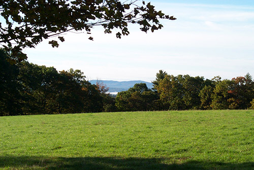
Stickney Hill Road
78 acres of open fields
Public access, no formal trails
December 2012
Situated at the top of Stickney Hill, on land first settled in 1807, Maplewood Farm has been in the Bunten family for three generations. The now elderly owners, Bill and Wayne, grew up milking cows and haying the fields as part of the dairy operation run by their father. Although the Buntens no longer have a working farm, their land is still part of the local farm scene.
Bohanan Farm (another Five Rivers conservation property), which is nearby, hays the Maplewood fields to feed its dairy herd. Stickney Hill Road runs through an historic agricultural district on the border of Concord and Hopkinton that has remained tranquil and undeveloped.
Bill and Wayne planned to retire after selling the farm but wanted to honor their father’s wishes to preserve the fields. Five Rivers worked with the neighbors, City of Concord, and the National Resource Conservation Service to raise the necessary funds to buy an easement. Under the terms of the conservation easement, Maplewood’s fields can never be developed or subdivided.
The easement protects the land on both sides of the road. Across from the farmhouse there is a large hay field with a view of the mountains to the west. Behind the house is another large field flanked by forest stretching back to I-89. There is also a small wetlands area in the northeast corner of the parcel. Currently, there are no trails on the property because the fields are still in use. However, Stickney Hill Road is just off of Concord’s walking/biking trail that runs parallel to the highway and Maplewood Farm is a beautiful sight for those passing by – as it always will be.
26 Penacook Street
14 acres of forest and wetlands with existing trails
Public access, no formal trails
March 2005
A variety of natural habitat, as well as early New Hampshire history have been preserved with a conservation easement on land in Penacook. Carol Foss and her husband Flip Nevers’ dream of protecting the land became reality on March 18, 2005 when Five Rivers accepted an easement on 14 acres of land near her home in the intervale of the Merrimack River in Penacook, a village in the north part of Concord. As a child growing up in Penacook, Carol spent many hours wandering the bluffs, woods and wetlands, and acquiring over time a deep love of the natural world.
Carol and her husband Flip Nevers have made numerous wildlife observations on the land. It has supported nesting pileated woodpeckers and broad-winged hawks, as well as a fox den. The varied habitat is attractive to many species of migratory songbirds, including scarlet tanager, sandpipers, ovenbird, rose-breasted grosbeak, warblers, grouse, thrushes and flycatchers. Moose, deer, turkey and even the occasional bear have been spotted there as well.
Two springs on the property that run year-round in even the driest years were utilized by the earliest European settlers in the area, who built granite boxes to collect the water. These stone boxes are still visible today.
The property has undeveloped frontage on both Cross and Penacook Streets, and expands an existing network of conservation lands that abut to the south. Trails crossing the Foss/Nevers property connect to trails on City land, providing a connection from Penacook Street to the Rolfe Park lands.
Dimond Hill Farm is one of the premier farm landscapes in the region. A working farm since the late 1700s, it consists of large open fields, both north and south of Hopkinton Road in Concord. Sitting atop a sloping hillside, the farm has panoramic views, and it serves as a visual milestone for travelers entering and leaving the city.
Under special conservation easements signed in June of 2006, the farm will remain a working farm, with Equity Trust serving as the owner and NH Preservation Alliance serving as the Historic Easement holder for the farm buildings.
Five Rivers Conservation Trust holds conservation easements for both the 74.8 acre Farm Easement portion and the 34.3 acre Forest Easement portion of the property.
The farm consists of open fields, an historic barn, and several greenhouses. Located on the Farm Easement is a wetland with nesting ducks, as well as a hidden, very-attractive field of wildflowers near the south border. On the north side of Hopkinton Road are pastures, a clearing with nice views, and forests of pine.
Also on the north side is the property’s 34-acre Forest Easement. It consists of a mixed hardwoods and softwoods, graced by a huge old ash tree near one of the property’s many stone walls. Traversing this Forest Easement section is Ash Brook, a hemlock-lined stream that tumbles its way downhill. A unique structure is an old ice pond dam of granite slabs, a structure used to collect ice in the winters which was sawed, stored under sawdust in a barn, and used during the summers.
Traversing the entire property is an attractive trail used by walkers, snowmobilers, skiers, and horseback riders. A variety of wildlife abound throughout this interesting property, including deer, fox, and many species of birds.
Broad Cove Road
15 acres with wetland, forest, and frontage on the Contoocook River
Public access, no formal trails
November 1993
In 1993 Eunice Clark donated a conservation easement on 15 acres of land on the Contoocook River to Five Rivers Conservation Trust. The land was subsequently given to the City of Concord, which manages the property for timber and allows public recreational use. The easement, which remains in effect, protects 825 feet of frontage on the Contoocook River and 800 feet of frontage on Broad Cove Drive.
The sandy soil is excellent for growing white pine and oak. Beavers have created a wetland on the brook that flows through the property into the river. The river frontage, with its majestic pines and overhanging silver maples, will remain an unspoiled scenic and ecological feature for all to appreciate.
Bog Road
50 acres with a stream, two meadows, and mixed forest in close proximity to Farrar Wildlife Management Area
Public access, no formal trails
May 2012
When Ken and Vicki Coffin bought their house on Bog Road in 1989, the accompanying land and its future development value was part of their retirement plan. Then, on an overcast, rainy night in April of 2000, Ken was reading Swampwalker’s Journal by David Carroll. He came across a chapter describing the mating habits of spotted salamanders which happened to occur on nights like that one. Out of curiosity, Ken decided to go outside. Spotted salamanders are a rare sight because they spend most of their time underground, only emerging after a rain to forage or mate. So you can image Ken’s surprise when he saw hundreds of the salamanders, just as Carroll had described. Ken and Vicki realized how important the marsh was to so many species and figured out that what they wanted to do was preserve the land, not sell it.
It took more than a decade to make that plan happen. Ken and Vicki contacted several groups but were limited by their desire to keep hunters and trappers off of the land. Eventually they attracted the attention of the Humane Society Wildlife Land Trust and Gordon Russell from the Russell Foundation. It was Russell who dedicated funds to the project and first brought Five Rivers out to the marsh. With additional support from the Hillsborough Conservation Commission, Five Rivers closed on the easement in May, 2012 with a cover easement for wildlife going to the Wildlife Land Trust.
The easement protects a large section of wetlands, fed by Sand Brook and spring water coming down from the mountains, and the nearby woods. To the north, on the eastern side of Bog Road, is the large, state protected Farrar Marsh and to the south lies Fox State Forest. The Coffin’s property in between has helped create a largely uninterrupted wildlife corridor. There are several active beaver lodges in the marsh and Ken and Vicki have reported seeing bobcats, moose, and all kinds of songbirds and raptors. There are no trails on the property but at the southern end of the easement, you can get a clear view, from the road, of the marsh and a couple beaver lodges.
The former owners of Sunnycrest Orchard also owned an orchard in Londonderry, and they needed to consolidate their operation. Rob Larocque, who had managed the orchard for many years decided he wanted to own it. Through a collaboration between Five Rivers Conservation Trust, the City of Concord, the Friends of the Orchard, the Trust for Public Lands, the NH Land and Community Heritage Investment Program (LCHIP), and the Federal Farmland Protection Program, this 155 acre property and its agricultural, forestry and recreational resources was preserved.
The orchard project exemplifies the goal of protecting not only open space but a quality of life that is rapidly disappearing. From picking berries in the spring and apples in the fall, to skiing the trails in the winter, to taking in the spectacular views from the top of the hill, the orchard offers something for everyone throughout the year.
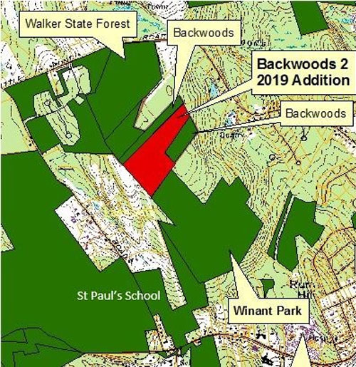
The Backwoods Preserve is a landlocked 54 acres that abuts Walker State Forest and Winant Park in Concord, NH. A ridge runs through the land making it unsuitable for building houses but the terrain does make for excellent wildlife habitat. Moose, deer, bear and coyote use this land as part of their territories.
Backwoods 1 (28 acres)
In 2002 a group of neighbors (the Backwoods Group) began the process to preserve this open space which is ideal for low impact recreational uses such as hiking, cross country skiing and mountain biking.
In 2003, with donations raised by the Backwoods Group along with funds from the City of Concord’s land use change tax fund, the property title was acquired by the city of Concord and the easement was placed on the land.
Backwoods 2 (26 acres)
“Backwoods 2” is a 26-acre addition to the original Backwoods property of 28 acres. This latest addition was purchased by the city in September 2019, who donated a conservation easement on the property to Five Rivers Conservation Trust.
This property is the missing piece, connecting Five Rivers-conserved Winant Park to Walker State Forest, creating nearly 200 acres of contiguous conserved land behind Concord Hospital and the Unitarian Universalist Church. Winant Park and Walker State Forest have been connected for years by a network of trails used by hikers and bikers, but there was no guarantee of continued access under private ownership. Now, thanks to the City’s foresight and commitment to conservation, this property will remain open to the public.
Ames Road
117 acres of forests and ponds
Public access with trails
September 2013
This Five Rivers’ easement, in Canterbury, has 117 acres of outstanding wetlands, ponds, streams and forest and is owned by Ned and Jean Therrien.
This property sits within the headwaters of the Soucook River and has numerous high value conservation attributes including a diverse, productive and well managed forest complete with a network of internal woods roads; varied habitat which supports a diversity of plant and animal species, and a variety of outstanding water resources including two ponds, streams and vernal pools.
On Shaker Road, North of Shaker Village
63 acres of forest and field with a brook traversing property
Public access, no formal trails
February 2003
This property, which is part of one of the oldest farms in Canterbury dates back to 1785, and was once part of the extended Canterbury Shaker Village. The protection of this property by Dave Emerson in 2003 was the fulfillment of a long time family goal. This property abuts other former Shaker land that was protected by the neighbors in the 1980’s as part of the Land Conservation Investment Program.
The property includes several secluded scenic fields that have been grazed or have been in hay production for many years. Behind the fields the property is wooded with pocket wetlands and a small scenic brook that traverses the land. This area is a known wildlife travel corridor that has been popular with local hunters for generations.
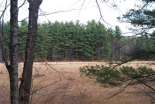
Route 140
188 acres of wetlands with frontage along the Tioga River
Public access
May 2012
In 2004, the Town of Belmont stepped in to rescue Tioga Marsh. The owner had been filling in sections so he could develop the property, ignoring multiple wetlands protection rules. The area is one of the highest ranked wetlands in Belmont and as such is an invaluable habitat for many flora and fauna. When the town saw what was happening, it offered to buy the land and the owner agreed. Since then, with new growth in the damaged areas, you would be hard pressed to spot the where the harm was done.
Despite being safe from development the wetlands face another problem; an infestation of the invasive plant, glossy buckthorn. This woody shrub was brought here from Europe and Asia by landscapers about a hundred years ago who thought its dark berries and thick leaves made it a fine ornamental shrub. But it likes marshes, grows quickly and keeps its leaves late in the season, all of which combine to squeeze out local plants.
Rick Ball, Belmont’s Land Use Technician has led the conservation efforts from the beginning to remove the glossy buckthorn. The Aquatic Resource Mitigation Fund approved a grant for the town to combat the infestation under the condition that the land was placed under easement. Belmont chose Five Rivers as a third party to handle that easement. Rick has enlisted the help of local high school students to help pull out the plants but it is likely that they will need a more efficient, mechanized approach to get the problem under control.
Tioga Marsh can be seen while driving along Route 140 and if you want to explore the land further there is a designated parking area and a walking trail that loops around the uplands portion of the property. The trail is not regularly maintained and can be hard to follow because of overgrowth. Parts of the trail also become washed out during periods of heavy rain. The best views of the marsh are from the road.
Trail Map Briar Hill Road and Route 103
Two parcels totaling 68.5 acres of fields, forests, and brook
Public access
October 2006
The 68-acre Ransmeier Woods property has two trails, offering both a field and woodland hiking experience within just a short drive of Hopkinton Village. The shorter trail circles a large hayfield and passes Smith Brook near an old dam. The longer trail continues through a mature woodland with views of the brook at the base of a steep ravine. The Ransmeier Woods trails connect to the Hopkinton Village Greenway from the longer loop trail.
Both trails start at the Police Station, skirting the right hand edge of the hayfield, then entering the woods and following Smith Brook along the edge of the woods close to the field. The trail passes near a now-broken dam/road across the brook that once provided access for farm vehicles. Shortly before a footbridge, the orange trail turns uphill to the left and returns to the field, circling the edge of the field back to the parking area. The Blue trail continues across the footbridge, with nice views of the brook, especially at times of high water, passing through mixed woodlands with some steeper pitches, crossing through some old stone walls and returning back to the bridge.
Clough Pond Road
15 acres of forest with a tumbling brook
Public access, no formal trails
December 2009
Tumbling through the property from north to south is Pickard Brook. The stream attracts a wide range of wildlife at all times of the year. Herds of deer are the most common, although bear and moose visit as well. Judy Nelson also keeps bird feeders at her house which bring a variety of birds to the property from woodpeckers to hummingbirds. At night she often hears owls.
In the warmer months it is possible to walk along old logging roads that can be reached from the driveway. Just south of the house the road splits, with one path leading along the stream, and the other continuing south and eventually connecting to trails maintained by the Sno-Shakers Snowmobile Club on Clough Pond Road. In the winter the logging roads make for nice snowshoe trails. Judy Nelson lives on the premises so if you visit the property, it is important to be respectful of the land and to keep noise levels to a minimum.
At just under 16 acres, the Nelson easement is one of the smaller easements Five Rivers holds, but is no less important to our conservation efforts. As Judy saw more and more houses popping up nearby, she made the decision to place an easement on her property in order to preserve the tranquility of Clough Pond Road.
Trail Map
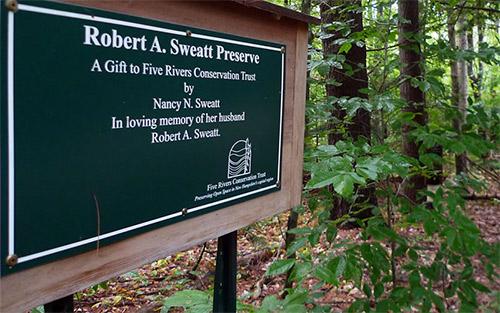
73 acres of mixed forest
Public access
November 2003
The Sweatt Preserve Nature Trail is located alongside Old Stagecoach Road near Hopkinton Village, a dirt road that rises from Briar Hill Road up to Gould Hill. Consisting of a 2-mile pathway marked by a roadside sign, the trail leads hikers and snowshoers deep into the forest, over brooks, up a slight hill, around a loop, and back to the start. Nature trail brochures are available at the trailhead, providing an overview of the property’s history and natural features.
This woodland trail is a great one for kids, with its two footbridges over a brook, hidden away in a hemlock grove at the bottom of a steep ravine. After the stream and a short climb, the trail loops back through thinly wooded former pasture land edged with stone walls.
The Sweatt Preserve was generously given to Five Rivers Conservation Trust in 2003 by Nancy N. Sweatt in loving memory of her husband, Robert A. Sweatt. Robert was a decorated veteran of World War II. During his many years in the service, he lived in various locations around the globe. His love for his boyhood town of Hopkinton and his land on Old Stagecoach Road never diminished. He and his wife were committed to preserving this land as a preserve for all to enjoy. The trail was built and maintained by volunteers from Five Rivers Conservation Trust.
The Five Rivers
The Merrimack, Contoocook, Blackwater, Warner and Soucook Rivers converge in an area of river bottom farmland and rolling hills that defines Five Rivers’ service area.

 Stark Highway North
 130 Hutchinson Road
 Stone Road
 Little Tooky & Penacook Roads
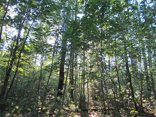 Maple Street
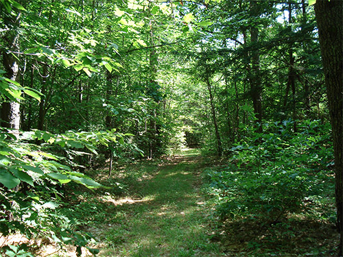
 Perkins Road
 Gleason Falls Road
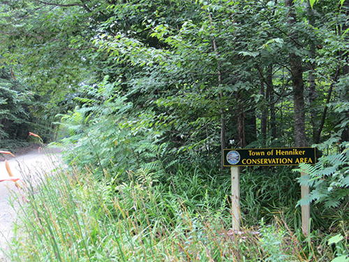 Warner Road and Brown Brook
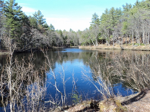 Western Avenue
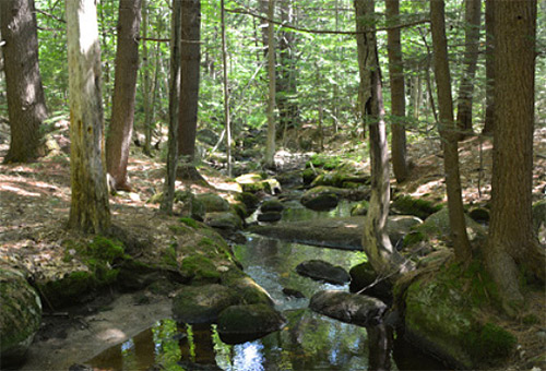
 Black Brook Road at the Goffstown town line
 Hopkinton Road adjacent to Dimond Hill Farm
 Stickney Hill Road
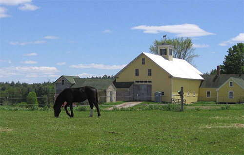
 Bog Road
 Ames Road
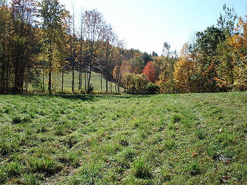 On Shaker Road, North of Shaker Village
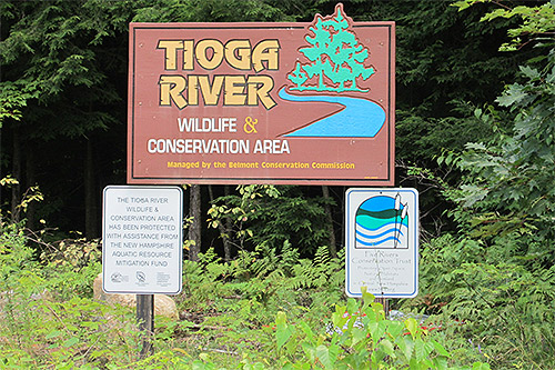 Route 140
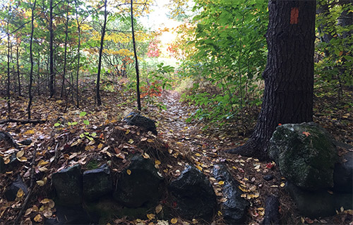
 Clough Pond Road