
Hopkinton – Ransmeier
 Trail Map
Briar Hill Road and Route 103
Two parcels totaling 68.5 acres of fields, forests, and brook
Public access
October 2006
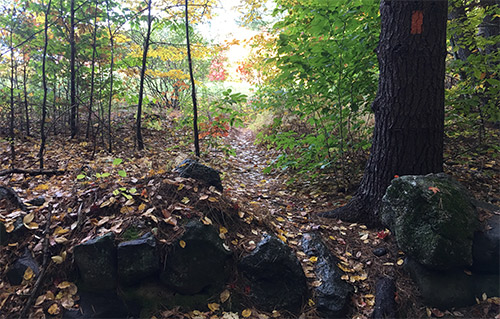
The 68-acre Ransmeier Woods property has two trails, offering both a field and woodland hiking experience within just a short drive of Hopkinton Village. The shorter trail circles a large hayfield and passes Smith Brook near an old dam. The longer trail continues through a mature woodland with views of the brook at the base of a steep ravine. The Ransmeier Woods trails connect to the Hopkinton Village Greenway from the longer loop trail.
Both trails start at the Police Station, skirting the right hand edge of the hayfield, then entering the woods and following Smith Brook along the edge of the woods close to the field. The trail passes near a now-broken dam/road across the brook that once provided access for farm vehicles. Shortly before a footbridge, the orange trail turns uphill to the left and returns to the field, circling the edge of the field back to the parking area. The Blue trail continues across the footbridge, with nice views of the brook, especially at times of high water, passing through mixed woodlands with some steeper pitches, crossing through some old stone walls and returning back to the bridge.
Click here to access the Hopkinton Conservation Land website, which includes a full description of the Ransmeier Woods trails and access to trail maps.