
Photo by Drew Groves
Stark Highway South
89 acres of fields, forest, and wetlands
No public access
February 2026
In February 2025, Five Rivers Conservation Trust announced the permanent protection of 89 acres of farm fields, forests, and high-quality wetlands at the Englund Family Farm in Dunbarton. The land and buildings were historically part of Dunbarton’s Twiss Farm, whose owners raised sheep, grew potatoes and hay, harvested timber, and built the stone walls that remain today. Many years later, in 1983, Thomas and Susan Englund purchased the property. Their daughter loved riding her horse on the trails, and their son spent hours exploring the old logging roads and fishing in the beaver ponds. Today, more than 40 years later, both children remain deeply connected to the land.
As their children grew older, Tom and Sue developed a keen interest in conserving the land. Brett St. Clair is a neighbor and Chair of the Dunbarton Conservation Commission, and they were friends with other conservation-minded Dunbarton residents like the Koerbers (Koerber Family Forest, conserved with Five Rivers in 2021) and the Stones (Stone Farm, conserved with Five Rivers in 2017). When Tom passed away in 2023, Sue drew on these connections and contacted Five Rivers, working closely with Five Rivers’ long-time volunteer project manager, Rob Knight, to begin the conservation process.
The Englund Family Farm is an important addition to an impressive network of conserved lands near Dunbarton’s village center. It is located about a half mile from each of three large clusters of conservation lands, altogether totaling over 18,000 acres extending across Dunbarton and three neighboring towns. The Dunbarton Conservation Commission has been actively protecting open space outside the village over the past several decades. This is Five Rivers’ sixth project in Dunbarton, where the organization now holds conservation easements on 915 acres.
Sue Englund feels fortunate that her children are solidly behind the permanent protection of this land. She comes from a family with a long appreciation of the outdoors and land conservation. Her grandfather emigrated from Switzerland to the San Francisco Bay Area in 1906 to work rebuilding the city after the devastating earthquake. True to his Swiss origins, he was an enthusiastic outdoorsman and collaborated with others in the Bay Area to establish the Sierra Club. His priorities remain strong with his descendants today.
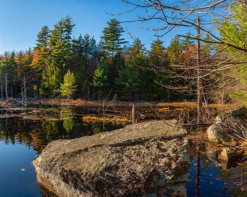
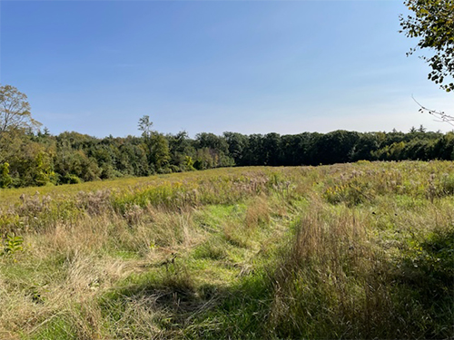
The Englund Family Farm includes a variety of highest-quality habitats. A 5-acre field in the southwest corner of the land is managed for hay and mowed regularly. The conservation area includes most of two large, active beaver ponds, a beautiful but fragile quaking bog, whose floating vegetation flowers in early summer, and two intermittent streams that eventually feed into the marshes north of Dunbarton’s Kimball Pond Tract. Small, forested wetlands occur throughout. Overall, the property’s hayfield, early successional woodland, beaver ponds, and numerous wetlands provide rich habitat that supports diverse wildlife, including bear and moose, turkeys, and wood ducks.
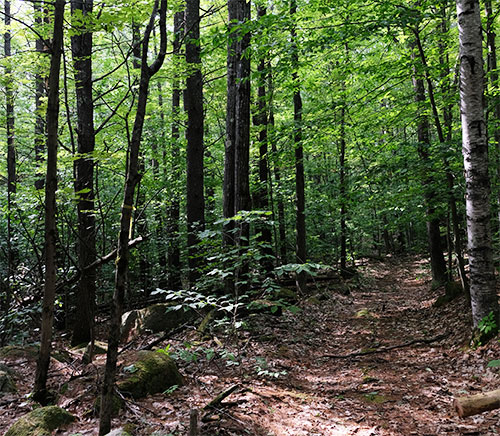
The property also offers excellent opportunities for future recreation and is an important link in the planned greenbelt around the village of Dunbarton. The conservation easement allows for the eventual development of a public trailhead, parking area, and hiking trails.
In addition to Rob and his thoughtful and persistent efforts on this project, many thanks go to Brett St. Clair and the Dunbarton Conservation Commission. Sue Englund donated the conservation easement, and the Conservation Commission funded up to $34,000 of transaction costs to make the easement project possible. “The Englund property is the old Twiss Farm, one of the older homesites in Dunbarton,” notes Brett St. Clair, Chair of the Conservation Commission. “Conserving it as open space, as with several other Five Rivers and Dunbarton Conservation Commission projects, helps to maintain the rural character of the village center.”
Brett St. Clair concludes, “We appreciate the Englund family’s love of their land and desire to pass that along in perpetuity.”
 Stark Highway North
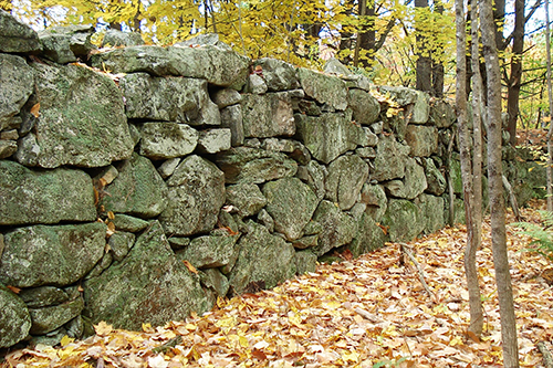 Stone Road
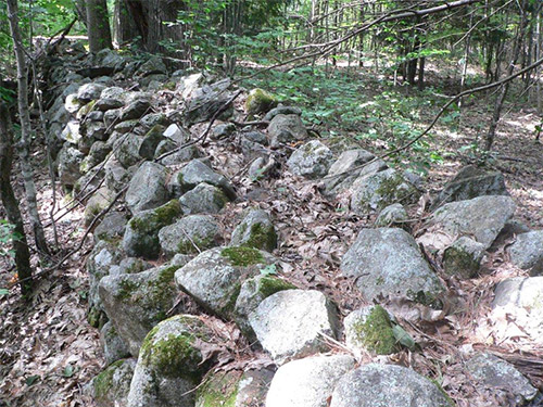 Grapevine and Guinea Roads
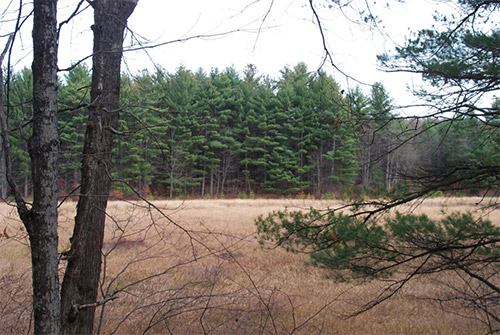 Black Brook Road at the Goffstown town line