Hopkinton – Houston

Main Street, Contoocook
55 acres of farm fields and river frontage
Public access
July 2019

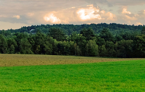
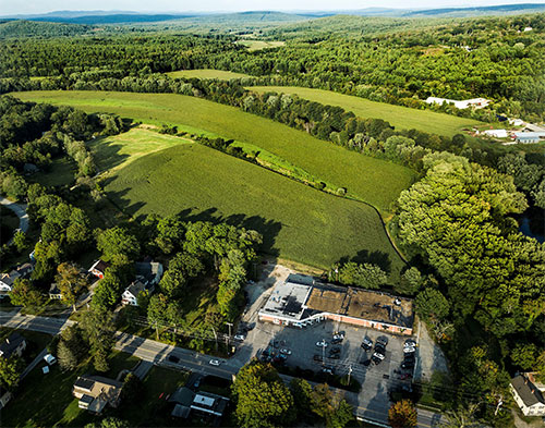
Five Rivers Conservation Trust and the Hopkinton Conservation Commission collaborated to permanently protect a 55-acre farm field in the center of Contoocook Village from future development.

The Houston family owns the field, located behind Dimitri’s restaurant and Colonial Plaza, as part of its Pine Lane Farm. The family has a long history of farming in Contoocook. Rich Houston, the third-generation of the family to manage Pine Lane Farm, has seen many acres of farmland lost to non-farm uses, so he wanted to permanently protect this prime agricultural land along the Contoocook and Warner Rivers. Houston says, “The viability of the farm depends on having enough good farmland to grow the corn silage and hay needed to feed our 450 milking cows.”

The Houstons’ goal of protecting their farmland meshed perfectly with the goals of Five Rivers and the Hopkinton Conservation Commission. Both organizations prioritize protecting working farmland and river frontage. This 55-field has the added benefit of being in the center of Contoocook village, across from the town’s Riverway Park and next to Contoocook’s iconic covered bridge. Keeping this agricultural land open is important to maintaining Contoocook’s rural character.

Five Rivers’ Executive Director, Beth McGuinn, said, “Conservation of this property means that this highest quality farmland will remain available for farming. Nearly a mile of undeveloped frontage along the Contoocook and Warner Rivers will continue to be a feature of Contoocook Village for those who live nearby, paddle the rivers, shop at the farmer’s market or visit the covered bridge.”

Rich Houston, co-owner of Pine Lane Farm, is committed to the continuing viability of his family farm – his children are already working on the farm. Rich would like to permanently protect all of the farm’s 180 acres of prime riverfront land.

Rob Knight, Five Rivers’ project manager, said, “It was great working with Rich Houston. He is so clearly committed to protecting his farmland for the future.”

Rich and his mother Edith will continue to own the farm field under conservation restrictions that prevent future development and require best management practices for agriculture. Five Rivers role continues into the future, monitoring the property each year, and working with Rich and future owners of the land to ensure that the conservation restrictions are honored.

Funding for the conservation project came from the Hopkinton Conservation Commission, the Thomas W Haas Fund, the NH State Conservation Committee’s Conservation License Plate Program and private local donations. Five Rivers is still accepting donations to cover the final costs of the project, with a goal of an additional $3500.

Continue Reading

Hopkinton – Albin/Hart

Kast Hill Road
27.5 acres
No public access
September 2018

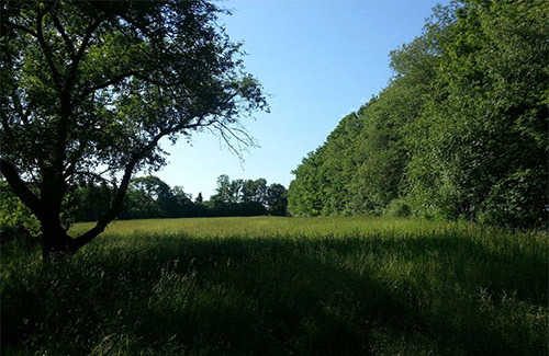
In September, 2018, Five Rivers completed conservation of 27.5 acres of prime agricultural land on Kast Hill Road in Hopkinton, thanks to the generosity of Francis M. Hart and the Town of Hopkinton.

The property includes fields that are ranked among the best wildlife habitat in the biological region. Mrs. Hart has conserved the field she cherishes — it will never be developed and will always remain available for hay production or other agricultural uses. She will continue to own the property, and manage it for conservation purposes, including agriculture.

Mrs. Hart is only the third owner of this field in over 100 years. Massachusetts Governor Frank Allen raised Guernsey cows here from 1915 until 1950. Fran’s parents, Harold and Christine Albin, bought the farm, attracted to the magnificent field and its acres of prime agricultural soils. Harold was retiring from the U.S. Department of Agricultural and he knew good farmland. Fran (Albin) Hart has owned the farm since 1975, and her conservation ethic will keep this field undeveloped in the future.

Continue Reading

Hopkinton – Rollins

rollins-pageLittle Tooky & Penacook Roads
46.7 acres
Public access, no formal trails
November 2011

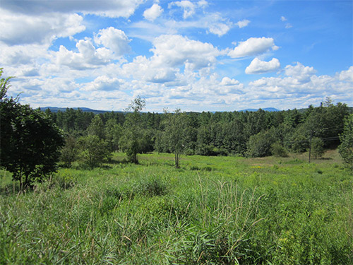
Sloping down from Penacook Road is an overgrown meadow of what used to be a chicken farm. The remains of old chicken coops can still be found on the property. At the base of the hill there is an overgrown railroad bed, part of what was the Concord and Claremont line. The Town of Hopkinton purchased the property using an Open Space Bond and passed the easement on to Five Rivers in 2011.

The field is part of what defines Contoocook as a rural area and the town preserved it before there was even a chance for development. Power lines cut across the field but do not take away from its beauty. Far and away the highlight of the property is its magnificent view of the New Hampshire landscape. Mt Kearsarge stands to the north and you can make out its summit fire tower on a clear day. There is a provision in the easement that the field will regularly be mowed to maintain the view.

There is no parking along Penacook Road but it is possible to pull over near the intersection with Gould Hill Road for pictures. However, there is also no designated lookout area so please use caution if you do step out of your car.

Continue Reading

Hopkinton – Rice

rice-pageMaple Street
210 acres
Public access, no formal trails
November 2011

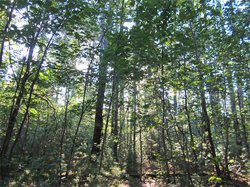
The Rice easement is largely forest that lies between Maple Street and the Contoocook River in Hopkinton. It was purchased by the Town using an open space bond. Hopkinton then went to Five Rivers in 2011 to place a conservation easement on the property.

A corn field lies along the northern edge of the woods. An old farm road cuts through the property to give a local farmer access.

There is no easy way to get to Rice, nor are there any trails once you reach the property. However the land is popular with hunters. Its wetlands and vernal pools attract deer, turkey, and other small game. The Town plans to hire a forest manager and sustainably log sections of the forest. If you just want to see the Rice lands, the best view would be from a boat on the Contoocook River.

Continue Reading

Hopkinton – Butterworth

butterworth-page

Jewett Road
24 acres of fields and woodlands with stream. Abuts ASNH Chase Sanctuary
No public access
October 2005

Five Rivers Conservation Trust received a new conservation easement in Hopkinton, thanks to the generosity and vision of Hope Butterworth. Hope donated an easement on 24 acres of land which is directly adjacent to NH Audubon’s Chase Sanctuary on Jewett Road in Hopkinton. The land is now owned by Ken and Cindi Hayden and will be incorporated as a portion of Contoocook Valley Farm. Currently the mainstay of Contoocook Valley Farm is sheep dog training, but the farm also supports a growing number of sheep, horses, cows, goats, llamas, ducks, and a donkey.

The property is about half woodland and half fields that have been fallow for a few years. There are beautiful white pines, and a mix of stately ash, oak and beech trees throughout. A small stream courses through the middle of the wooded portion and the associated hemlocks provide wonderful cover for deer and other wildlife. The property also shares 1,600 feet of common boundary with the NH Audubon Society’s Chase Sanctuary, contributing to what is now a large block of open space of over 785 acres.

Continue Reading

Hopkinton – Dustin

dustin-pageTrail Map
Dustin Road
35.8 acres of forests, wetlands, and farmland
Public access
November 2014

The Dustin easement is almost completely forested. One area near the road was most recently pasture and is now a nearly pure stand of white pine. Most of the property is upland forest consisting of a mixture of scattered larger white pines with some red oak above an understory of smaller oak, red maple, beech and birch. There is a flood plain forest near the river consisting of silver maple with some elm and abundant shrubs. There is a hemlock stand near the stream.

The property has outstanding wildlife habitat value due to its varied habitats and proximity to the river. The NH Wildlife Action Plan shows this property as abutting and supporting some of the highest ranked habitats in the region.

Wetland areas are near the river and include over 1,600 feet of frontage on the Contoocook River. The property has over 825 feet of scenic frontage along Dustin Road. Trails connect to the Bohanan Farm Trail network.

Click here to access the Hopkinton Conservation Land website, which includes a full description of all Bohanan Farm trails and access to trail maps.

Continue Reading

Hopkinton – Carson

Farrington Corner Road
35 acres of forests and wetlands
Public access
June 2006

The Carson Property is a 35-acre parcel located along Farrington Corner Road in Hopkinton. It is owned by the Town of Hopkinton, which signed the property’s conservation easement in June of 2006.

A former pasture, the Carson Property now consists of extensive forest stands, notably red oak, hemlock and other species. A small brook courses its way across an undulating terrain of glacial deposits. Beneath the property the bedrock is both Concord Granite of Devonian age and a Silurian age schist of the remarkable Smalls Falls Formation.

The property is located next to New Hampshire Audubon’s Brockway Nature Preserve, a parcel with some delightful walking trails. The newly-protected Carson Property creates an additional forest buffer around that preserve, thereby serving to expand the conserved acreage in this part of Hopkinton while enhancing the experience for those who enjoy the nearby Audubon preserve.

Continue Reading

Hopkinton – Bohanan Farm

bohanan-pageTrail Map (West)
Trail Map (East)
Contoocook Creamery website
Contoocook Creamery Facebook page
Penacook Road
413 acres of farmland
Public access
June 2010

Bohanan Farm has been in existence since Lester Bohanan bought the land in 1907. From the 1930s on, the farm became primarily a dairy farm and has grown with every new generation. Lester’s great-grand-daughter, Heather, married Jaime Robertson, who currently manages the over 400-cow operation.

In 2008 the family decided the best way to ensure the land remained unaltered for future generations was to place an easement on it. However the cost to do so was quite substantial and Jaime asked the Town of Hopkinton if they were interested in purchasing the development rights. Hopkinton’s Open Space Committee began building support for the idea among the voters while Five Rivers got involved and raised money through state and federal grants as well as generous private donations. The State of NH and the National Resource Conservation Service through its Farm and Ranch Lands Protection Program also provided valuable assistance.

In the largest town meeting in the town’s history, Hopkinton residents overwhelmingly voted to preserve the farm. After the land was under easement, Jaime decided to widen the scope of the farm. He created the Contoocook Creamery and you can find their milk in traditional glass bottles in many local grocery stores. The Robertsons also sell eggs and have started raising cattle for beef, not just milking. Blueberry and raspberry patches are also in the works and should be ready for the public in a couple of seasons. Logging has always brought in extra income for the farm but is done in a sustainable manner. There are large cornfields on the property that produce about 50% of the cow’s feed over the course of the year.

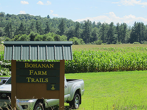
For years there have been trails on the property that were open to the public but now that Hopkinton maintains them, there is a designated parking area and they are clearly mapped and marked. Click here to access the Hopkinton Conservation Land website, which includes a full description of all Bohanan Farm trails and access to trail maps.

The Courser Hill Loop trail is a 2.3 mi round trip and starts from the parking area. It heads along the Contoocook River past a canoe and kayak launch, around a field and then cuts inwards towards Courser Hill. Once in the woods the trail divides into the loop portion. The trail has a long stretch through the woods and another sizeable stretch that cuts through Courser Hill pasture and over the top of the hill. At the top of the field there is a small grove of trees with an old cellar hole at the center. You should be aware that at certain times of the year there may be cows grazing in the pasture.

Across the road from the main farm, along Burrage Road, there is the 1.5 mi Blackwater River Loop trail. It cuts in past a cornfield and leads into the woods. There is a lookout point over the Blackwater River on the north-west part of the trail. The path also leads past several vernal pools. This trail is ideal for cross-country skiing and biking in addition to being a nice walking route.

The newly added Contoocook Overlook Trail (conserved by the Town of Hopkinton and owner Donelda Horne and not Five Rivers) leaves the Blackwater River Loop at the half way point, adding ¾ of a mile to the Blackwater Loop (2.2 miles total with the overlook trail). The trail follows a bluff above the Blackwater River before turning toward the Contoocook River where an overlook provides beautiful views where the two rivers converge. The trail climbs a short hill to a bluff along the Contoocook River, follows through mature woodlands with views over Bohanan fields, and rejoins the Blackwater River Loop. Click here to access the Hopkinton Conservation Land website, which includes a full description of the Contoocook Overlook Trail and access to trail maps.

After your hike, don’t forget to say hello to the cows. They’ll appreciate it.

Continue Reading

Hopkinton – Bermuda

Bound Tree Road
111 acres of forests and wetlands in both Hopkinton and Warner
Public access
June 2006

The Bermuda-Harris Property, which is owned by the Town of Hopkinton, is an attractive 111-acre landscape that straddles the Hopkinton-Warner town line. It fronts on both Bound Tree Road and Pleasant Lake Road, both in Hopkinton. The Town signed a conservation easement for the property with Five Rivers Conservation Trust in June of 2006.

This preserve is particularly well suited for recreational trails that allow public access to some wonderful natural features. Mature stands of hemlock, pine, and hardwoods, as well as a large black gum tree rare to this northern environment, are just a few of the property’s attributes. Also, in addition to a delightful brook, once used in the 1700s to power a small, long-since-disappeared mill, the forested landscape is graced by a remote, hidden, beaver pond. Along with a number of surrounding vernal pools, this isolated wetland, as well as the rest of the forestland, is frequented by deer, turkeys, hawks, songbirds, and other wildlife. The Bermuda-Harris Property also exhibits some interesting glacial formations, as well as old cellar holes and other legacies from a bygone era.

Continue Reading

Hopkinton – Ransmeier

ransmeier-pageTrail Map
Briar Hill Road and Route 103
Two parcels totaling 68.5 acres of fields, forests, and brook
Public access
October 2006

The 68-acre Ransmeier Woods property has two trails, offering both a field and woodland hiking experience within just a short drive of Hopkinton Village. The shorter trail circles a large hayfield and passes Smith Brook near an old dam. The longer trail continues through a mature woodland with views of the brook at the base of a steep ravine. The Ransmeier Woods trails connect to the Hopkinton Village Greenway from the longer loop trail.

Both trails start at the Police Station, skirting the right hand edge of the hayfield, then entering the woods and following Smith Brook along the edge of the woods close to the field. The trail passes near a now-broken dam/road across the brook that once provided access for farm vehicles. Shortly before a footbridge, the orange trail turns uphill to the left and returns to the field, circling the edge of the field back to the parking area. The Blue trail continues across the footbridge, with nice views of the brook, especially at times of high water, passing through mixed woodlands with some steeper pitches, crossing through some old stone walls and returning back to the bridge.

Click here to access the Hopkinton Conservation Land website, which includes a full description of the Ransmeier Woods trails and access to trail maps.

Continue Reading

Hopkinton – Sweatt

Trail Map
73 acres of mixed forest
Public access
November 2003

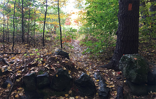
The Sweatt Preserve Nature Trail is located alongside Old Stagecoach Road near Hopkinton Village, a dirt road that rises from Briar Hill Road up to Gould Hill. Consisting of a 2-mile pathway marked by a roadside sign, the trail leads hikers and snowshoers deep into the forest, over brooks, up a slight hill, around a loop, and back to the start. Nature trail brochures are available at the trailhead, providing an overview of the property’s history and natural features.

This woodland trail is a great one for kids, with its two footbridges over a brook, hidden away in a hemlock grove at the bottom of a steep ravine. After the stream and a short climb, the trail loops back through thinly wooded former pasture land edged with stone walls.

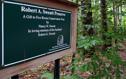
The Sweatt Preserve was generously given to Five Rivers Conservation Trust in 2003 by Nancy N. Sweatt in loving memory of her husband, Robert A. Sweatt. Robert was a decorated veteran of World War II. During his many years in the service, he lived in various locations around the globe. His love for his boyhood town of Hopkinton and his land on Old Stagecoach Road never diminished. He and his wife were committed to preserving this land as a preserve for all to enjoy. The trail was built and maintained by volunteers from Five Rivers Conservation Trust.

Click here to access the Hopkinton Conservation Land website, which includes a full description of the Sweatt Property and access to trail maps.

Continue Reading